lordroel
Administrator
Posts: 67,964 
Likes: 49,369
|
Post by lordroel on Apr 28, 2018 19:53:20 GMT
Maps: The Changing Geography of Wakanda
Wakanda, a country famous for having been visited in movies like the Black Panther and Avengers: Infinity War has seen many iterations since his first appearance in Marvel Comics in 1966, the country which can be regarded as one of the most scientifically advanced country's in the world (disputed by Latveria) has due its isolation enabled it to resist colonization and to develop its own independent technology. Map I
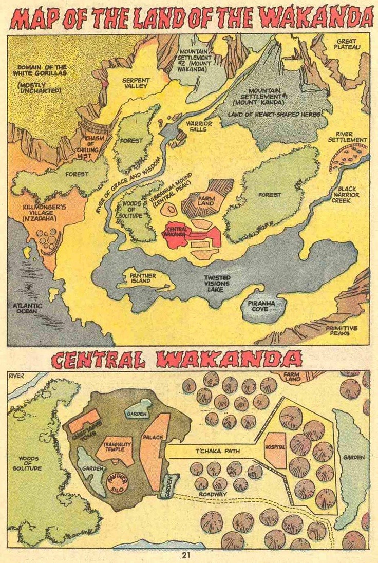
The first map, from Jungle Action Volume 2 #6, shows the Atlantic Ocean in the lower left placing Wakanda near the west coast of Africa.  Map II Map II
A couple of episodes later the map was re-presented "with new details." The Atlantic Ocean was removed, probably to place Wakanda more in East Africa. Killmonger's Village is no longer a coastal settlement. There is an arrow in the bottom left of the map pointing to the Indian Ocean. There is speculation that they "flipped" the map (south is now up).  Map III Map III
This became the definitive version of the map for decades. In 2008, Marvel published its Atlas of Fantastic Places giving a precise location of Wakanda and neighbors between Ethiopia and Kenya.  Map IV Map IV
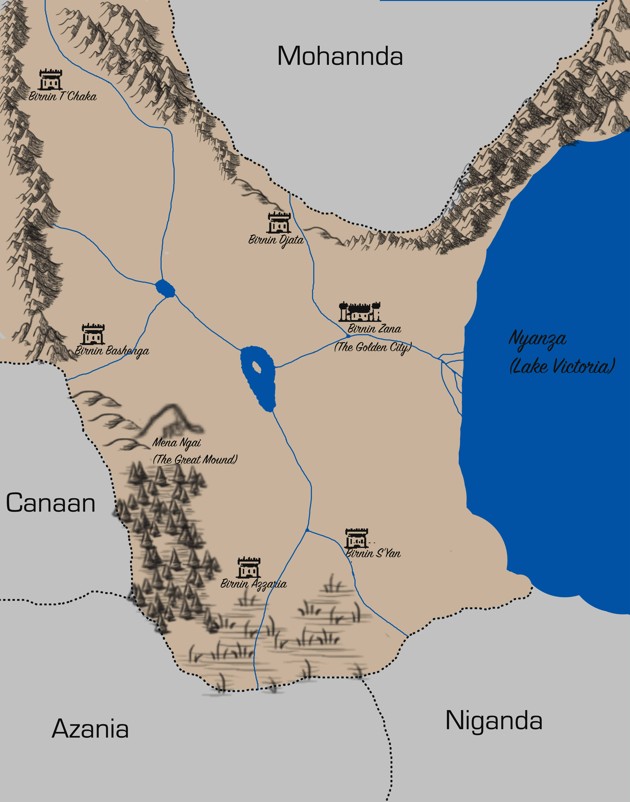
In 2016, a new version of the comic was written by Ta-Nehisi Coates. He drew a couple of new iterations of the map placing it on the western shore of Lake Victoria. Building The World Of Wakanda Map V Map V
 Map VI Map VI
In the movie Captain America: Civil War, Wakanda appears to the northwest of Uganda, close to the location from Marvel's atlas.  Map VII Map VII
The movie Black Panther shows the country slightly to the southwest of the Coates map bordering on Rwanda's Lake Kivu. 
|
|


