|
|
Post by Max Sinister on Aug 17, 2023 1:28:57 GMT
|
|
lordroel
Administrator
Posts: 65,017 
Likes: 46,236
|
Post by lordroel on May 3, 2024 18:34:28 GMT
Found on Twitter (X): "The Battlefronts of Europe", 1917, a superimposed and Mercator-adjusted image of the four major European WWI battlefronts on the contiguous United States. 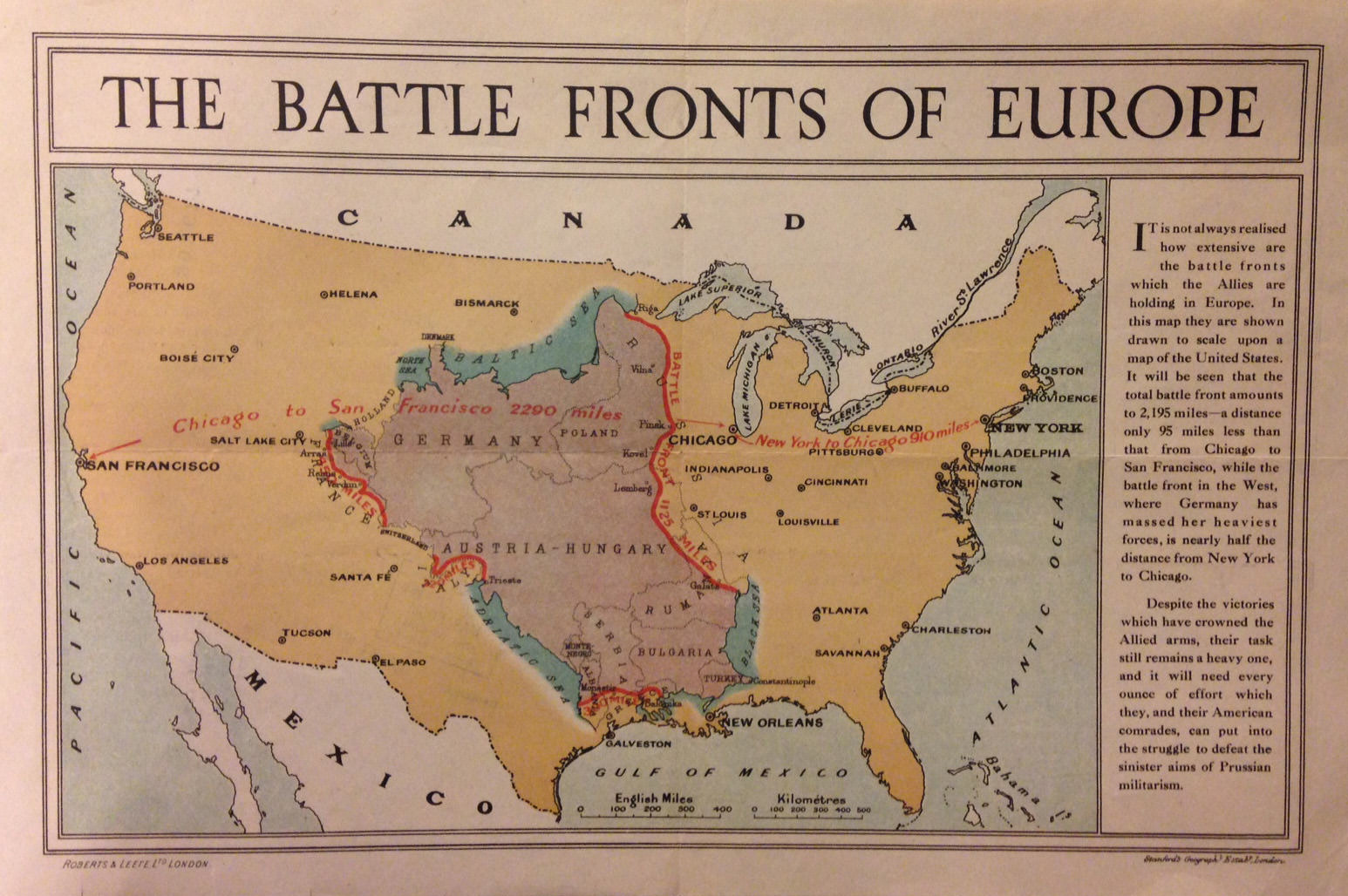 |
|
|
|
Post by Max Sinister on May 4, 2024 13:57:43 GMT
From this site. The situation on the very evening of May 24th in 1940 near Dunkirk.
|
|
michelvan
Sub-lieutenant
Posts: 444
Likes: 721
|
Post by michelvan on May 6, 2024 15:38:42 GMT
This World Map is from The Free Republic of Outremeuse  Grey areas Europe: The United States of Europe under dominion and protection of Greater German Reich. (China are they ally) Afrika: Mittelafrika colony of Greater German Reich, in transition to become independent state. Britain and its dominion form the Commonwealth of nations, supranational political, economic and Defence union (USA are there ally) |
|
lordroel
Administrator
Posts: 65,017
Likes: 46,236
|
Post by lordroel on May 6, 2024 15:41:48 GMT
This World Map is from The Free Republic of Outremeuse Grey areas Europe: The United States of Europe under dominion and protection of Greater German Reich. (China are they ally) Afrika: Mittelafrika colony of Greater German Reich, in transition to become independent state. Britain and its dominion form the Commonwealth of nations, supranational political, economic and Defence union (USA are there ally) This map is your own creation, unless you have a double we do not know off. |
|
michelvan
Sub-lieutenant
Posts: 444
Likes: 721
|
Post by michelvan on May 6, 2024 15:54:54 GMT
This map is your own creation, unless you have a double we do not know off. ups, let me say it like this: I found map on flickr... |
|
|
|
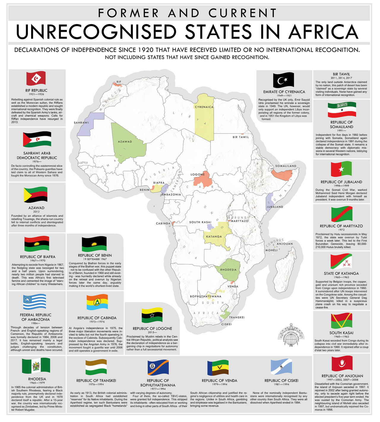
Post by Max Sinister on May 11, 2024 21:14:05 GMT
There are many maps done in this style, but it seems that this was the first one before it went memetic. Found it here.
|
|